A case study of how modifications to the workflow saved a customer from trying to process massive datasets and spending budget on new hardware
A case study of how modifications to the workflow saved a customer from trying to process massive datasets and spending budget on new hardware
Short discussion on why alignment can fail and what techniques can be applied to overcome the issues.

Support for Ukraine and those affected by the conflict via a 50% donation to charity on behalf of anyone taking an AccuPixel training course.

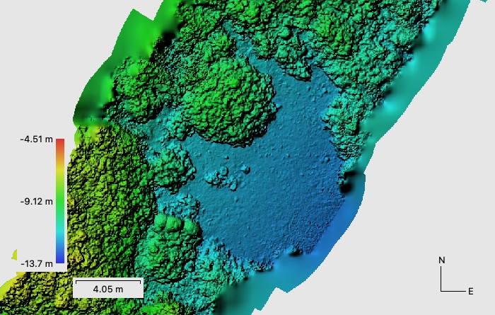
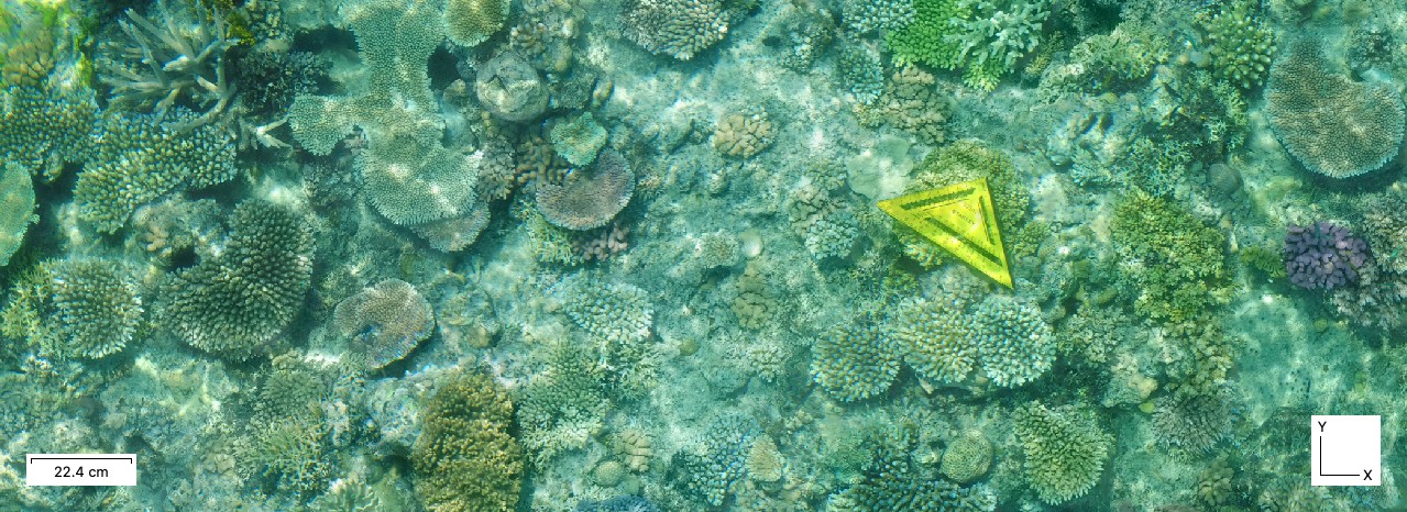
A deeper analysis of why image alignment was failing with a coral reef photogrammetry dataset.
AccuPixel and Geobit joint statement on the ongoing conflict in Ukraine
Short video explaining the installation and use of the AccuPixel Camera Position App
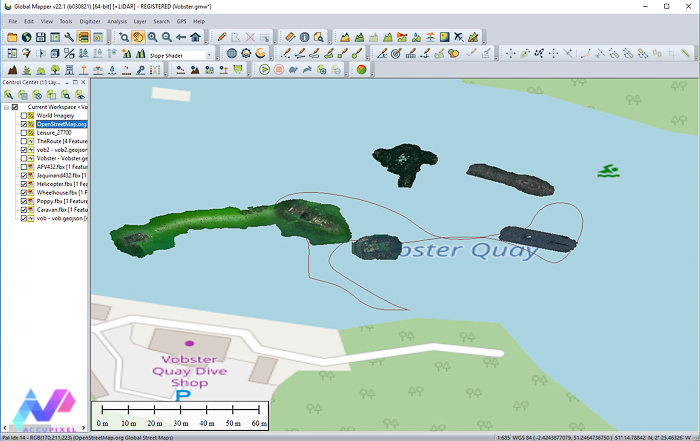
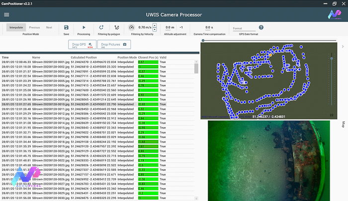
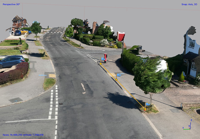
Using Global Mapper GIS tools to merge UWIS track logs with geo referenced 3D models derived from Metashape and generate video output

Underwater photogrammetry and UWIS diver tracking and data acquisition training for an AccuPixel client at Capernwray Diving Centre
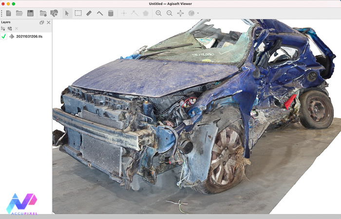
A closer look at the latest release of the Agisoft Viewer, a free app that enables viewing and measurement of 3D and 2D content.
A look at using cost effective GoPro and Mavic Mini drone cameras to gather source images for 3D reconstruction in Metashape Professional