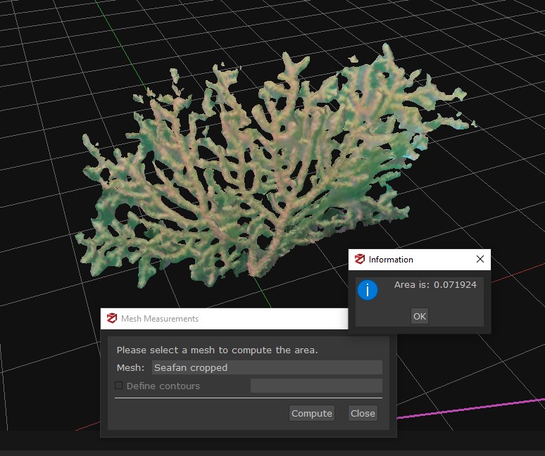
Underwater Sea fan Photogrammetry Survey techniques continue to expand the role of underwater photogrammetry in marine conservation, reef health monitoring,…
Underwater Sea fan Photogrammetry Survey techniques continue to expand the role of underwater photogrammetry in marine conservation, reef health monitoring,…
Photogrammetry quickly generates a mass of images, cohesive data and image management is paramount in optimizing your photogrammetry workflow. Simple…

Photogrammetry is transforming digital documentation across multiple industries and learning photogrammetry might help advance your skillset in your field. Today,…

Photogrammetry site monitoring turns every survey into living, raw, data. AccuPixel’s recent project uses photogrammetry for conservation and precise 3D…
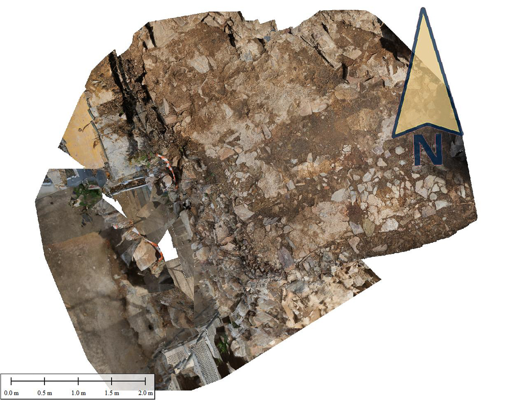
Are we walking in the footsteps of history; in our most recent study, applying photogrammetry for Roman History, José, took…
Recent news regarding Scapa Flow’s categorisation as Scotland’s newest Historical Marine Park brings to light the capacity of photogrammetry in…

Guest Blog by Tim Clements

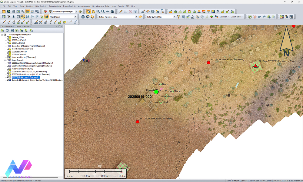
Taking GIS Data into the Field with Global Mapper Mobile Global Mapper Mobile is changing how teams handle GIS data…

Real world photogrammetry is transforming how we capture and preserve physical objects in digital form. The advent of computer technology…

LiDAR training with Metashape is now part of our online Metashape Professional Edition for Forensics & Surveying Course for professionals…