Last year, AccuPixel published a blog demonstrating how drone based photogrammetry was being used to create objective evidence on how mountain biking trails were eroding.
We have patiently waited for the vegetation to die back and this month we returned to the trails and put the drone up. It was a very frosty day. Battery level warning was set a little higher than normal.
Why was photogrammetry and objective evidence considered important? The short answer is the landowner is very hostile to mountain biking and despite a remit to support recreation has raised very subjective concerns in an attempt to ban MTB. Objective evidence remains the best method to set policy…and counter subjective objections.
Two flights and 40mins later both trails were covered.
Post Flight Analysis
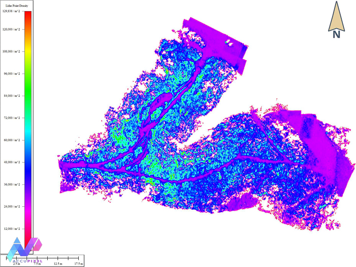
We applied the survey points from the 2021 survey and processed both models. The dense cloud, DEM and ortho photo were saved and imported into the Global Mapper project. This is the strategy we will use for Photogrammetry And creating Objective Evidence.
Global Mapper is one of those applications that just grows on you. Jose loves it and just about any GIS question can be answered using its rich toolkit.
We loaded the 2021 and 2022 versions of the DEMs and orthomosaics as separate layers.
Moreover, the dense vegetation lines the routes in the area. The dense vegetation lines the routes in the area.” We didn’t really want to measure changes in the bracken growth and dieback (but we could if needed) so the first step was to create a median centreline along the trails.
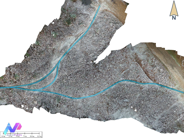

Then, we used the Buffer tool to create areas around the trails. Mountain biking trails are narrow and in these two cases 1m and 0.5m were enough to make sure the scope of analysis covered just the areas where erosion might have occurred. We are building a supportive case via Photogrammetry and Objective Evidence.
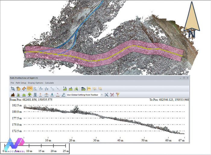
With the specific areas of interest we then ran the analysis on each using Global Mapper’s Measure Volume Between Surfaces… tool.

The Good News!
The good news? In both areas any erosion or trail wear was too small to record changes. We do not know the volume of traffic so true objectivity is challenging but both trails are in active use and ridden regularly.
With considerable confidence, thanks to Photogrammetry And Objective Evidence, we can say mountain biking isn’t causing measurable harm or damage.
The second set of analysis was to look into the future and review how rainfall and runoff might accelerate. Do the trails act as drainage channels? Are there any changes we can make to divert or slow the flow?
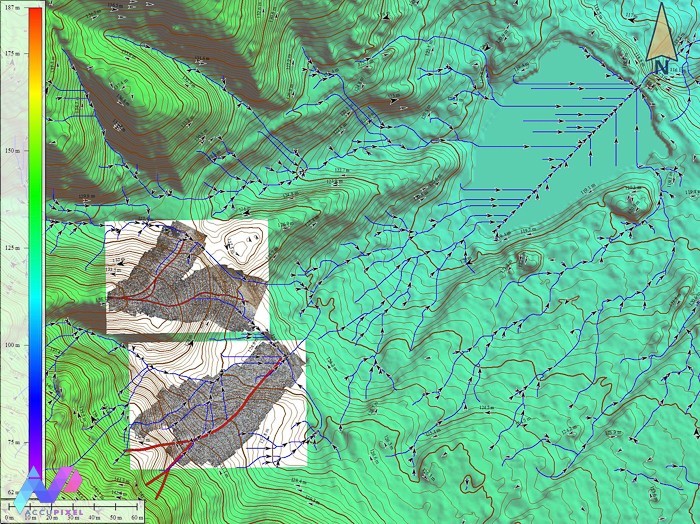
Global Mapper has a Watershed analysis tool that maps runoff and flow using open government LIDAR derived DEMS as as the basis:

The image shows the trails in red with the orthomosaics of each trail, plus the contour lines and results of Global Mapper’s Watershed analysis tool.
Also, the terrain is typically sand and gravel making it exceptionally well drained with poor topsoil. This geological feature has kept it undeveloped and now a superb area for recreation irrespective of the weather. The flow channels as predicted by Global Mapper show the trails follow natural ridge lines and most of the water will flow away from the trail, limiting runoff as a potential accelerant for erosion.
Evidence to support claims
Both the trails are close to watercourses that drain into a reservoir. Had erosion been an issue and concern then any silt runoff may be causing harm to water management or wildlife further downstream.
This kind of analysis, provided by Photogrammetry And Objective Evidence, really helps us predict risks and mitigate them. Instead of fixing problems after the occur the mountain biking community can start to think about preventative changes ahead of causing damage.
Summary of Photogrammetry And Objective Evidence
Conclusively, Objective evidence (provided by photogrammetry) is priceless and this kind of data will help the mountain biking community monitor and mitigate risk of erosion and potential harm to what is quite a fragile and precious environment.
Furthermore, it helps landowners and politicians understand the actual level of harm that an otherwise highly beneficial sport causes, rather than just the perceived harm.
In summary, this is what Simon and Jose love about photogrammetry and analysis. Creating 3D shapes are all very good. However, their true value is how the knowledge is applicable to making the world a better place.
Conclusively, do you want to know more about Global Mapper and the analysis of photogrammetry data? Then please use the contact us page to get in touch.
Great article! Policies based on Evidence and collected data is the direction we need to be moving. Keep mountain biking accessible for the public while developing the best trails with consciousness and preventative actions to ensure nature remains balanced