
Photogrammetry is transforming digital documentation across multiple industries and learning photogrammetry might help advance your skillset in your field. Today,…
Photogrammetry is transforming digital documentation across multiple industries and learning photogrammetry might help advance your skillset in your field. Today,…
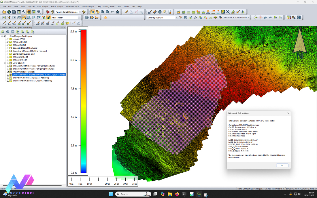
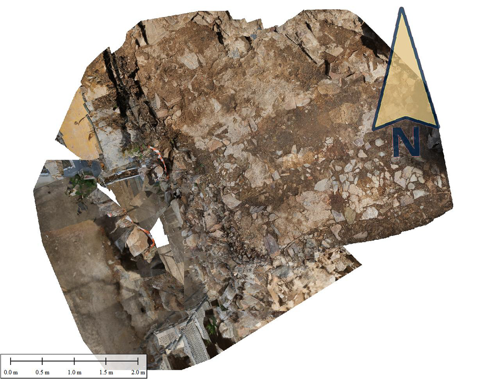
Chesil’s dragon teeth represent a rare and increasingly vulnerable relic of WWII coastal defenses, preserved within a dynamic environment– perfect…

Photogrammetry site monitoring turns every survey into living, raw, data. AccuPixel’s recent project uses photogrammetry for conservation and precise 3D…
Recent events have made us wonder: Can we use photogrammetry in the preservation of art and rare items? This year,…
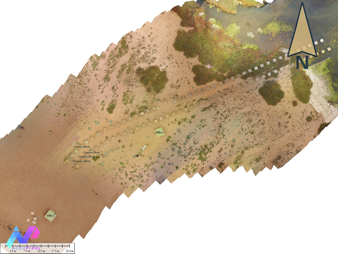
The Military Heritage of Chesil’s Dragons’ Teeth Surveying dynamic and stable environments can be a perplexing task for a photogrammetrist.…
Are we walking in the footsteps of history; in our most recent study, applying photogrammetry for Roman History, José, took…
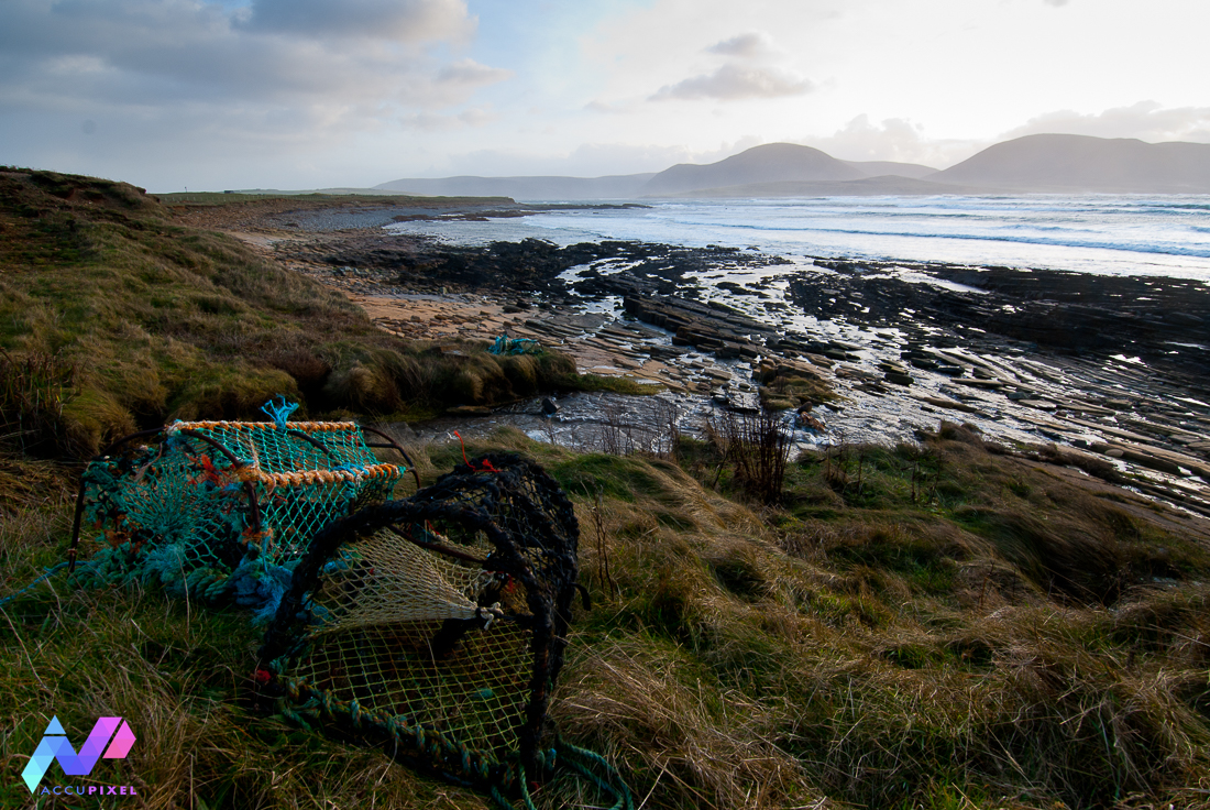
Recent news regarding Scapa Flow’s categorisation as Scotland’s newest Historical Marine Park brings to light the capacity of photogrammetry in…

Guest Blog by Tim Clements

Taking GIS Data into the Field with Global Mapper Mobile Global Mapper Mobile is changing how teams handle GIS data…
A new method is rapidly gaining traction for digitally recording the world around us: Gaussian Splatting. Photogrammetry has long been…