Estimated reading time: 5 minutes
Photogrammetry site monitoring turns every survey into living, raw, data. AccuPixel’s recent project uses photogrammetry for conservation and precise 3D site monitoring to actively track how heritage environments change, deform, and erode over time. Simon’s most recent publication, co-authored by Jon Henderson, in the Journal Heritage, evaluates photogrammetry for site monitoring. The article, “Documenting Change on the SS Thistlegorm, Red Sea, Egypt: Using Underwater Photogrammetry to Record Natural Deterioration and Human Impacts on a World War II Shipwreck” is one of the finalized reports stemming from the collaborative project (University of Edinburgh and the University of Alexandria) “Wrecks at Risk,” an extension of 2017’s “Project Thistlegorm.”
Thistlegorm: A case study in photogrammetry for conservation
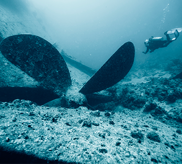
An ambitious endeavor, the project focused on recording and monitoring the conditions of one of the world’s most popular and historic shipwrecks to dive. Lost in a German air raid off the south-western coast of Sinai in October 1941, SS Thistlegorm later rose to fame through Jacques Cousteau’s films and writing. Originally a British cargo vessel, she was refitted to carry munitions and supplies to rearm Allied forces stationed in Alexandria. While lying at anchor, a German Heinkel bomber spotted her and dropped two bombs into the cargo holds triggering a fire that in turn ignited the cargo of ammunition, sinking the 125-metre ship.
Why Monitor Sites in 3D?
Looking back on recent blogs, it is evident Simon enjoys conducting photogrammetric surveys underwater. Often taking the opportunity to use photogrammetry to create a baseline for future site monitoring. When a site is documented with photogrammetry, the model creates a point of comparison for future surveys– we call this a baseline. As such, Simon’s 2017 scans of Thistlegorm created a baseline scan, a point of reference for the 2022 survey. Given that, the 2022 survey of the same site provides invaluable data for analysis. Additionally, Simon can leverage comparison within an extensive dataset, spanning a 5 year duration, to evaluate the wreck site for changes. Additional and periodic site scans, enable photogrammetry to be of use for comparative site monitoring and conservation purposes.
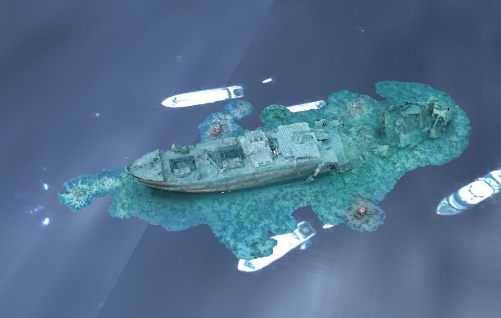
Photogrammetry for site monitoring provides an established, effective, and non-invasive 3D measuring technique for recording underwater cultural heritage. By deriving metric information from overlapping photographic imagery, it enables the generation of highly detailed, textured models. The 3D flyover of the model below shows how intricate these scans can be. Consequently, we are creating 3D Models that are both visually interpretable and metrically accurate. Compared with other recording methods such as video, photos, manual tape measurements, or single or multibeam sonar, photogrammetry offers several advantages. Moreover, It captures complex geometries at millimetre-scale resolution, requires minimal contact with the site, and can be repeated easily to monitor change over time.
From 3D Baselines to Measurable Change: Photogrammetry Site Monitoring on Thistlegorm
The resulting 3D datasets can be georeferenced, measured, and analysed quantitatively. This allows objective comparison between surveys as well as high quality visual outputs for interpretation, conservation, and public dissemination.
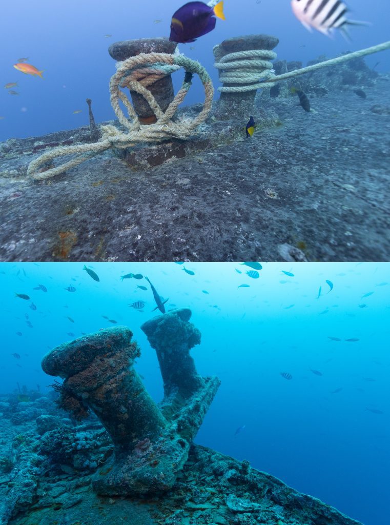
Consequently, repeated scanning shows photogrammetry can be successful in site monitoring and heritage management. In fact, photogrammetry allows for a precise 3D model of a site or object creating a baseline for future reference. Given that, conservationists can compare repeated photogrammetry scans to watch for changes on a site. In the case of Thistlegorm, Simon saw numerous site changes through comparing the 2017 and 2022 photogrammetry scans. However, discrepancies show continued looting of the wreck, movements of artefacts, and structural degradation. We can see corrosion and structural loss caused by exhaled bubbles from divers and damaging mooring practices.
Conclusions on Photogrammetry and Site Monitoring
So while photogrammetry is not an immediate solution to improving the condition of a site, it is a worthwhile tool for evaluating a site’s current condition and monitoring changes over time. As we have seen in the Thistlegorm case, we can precisely prove loss of structural integrity and artefacts. Comparing the 2017 and 2022 scans makes a strong case to support the installation of tonnage-appropriate moorings and concerted outreach initiatives with the dive community. As we have seen, the dive community has shown a receptive nature to working with heritage experts. Thus, a tangible solution is raising awareness and behavioral standards, within the diving community, for protecting underwater cultural heritage.
Photogrammetry is becoming increasingly popular with cultural heritage management and commercial surveys. The precise and noninvasive nature of photogrammetry continues to find new applications. We are happy to apply the technology towards the efforts of continuing and improving preservation methods around the world.
![]() Keep up with us on LinkedIn here
Keep up with us on LinkedIn here
![]() Like and Follow us on Facebook here
Like and Follow us on Facebook here
![]() Subscribe to our Youtube here
Subscribe to our Youtube here