Do you ever wonder how to scan, scale, and geo-locate a large underwater structure like the SS Thistlegorm with photogrammetry? The process of recording historical and archaeological sites is changing due to technological advancements. In the past, a pencil, paper, and some artistic skill were the standard method of recording a site.
However, modern cameras and software make it possible to record a large site, like the SS Thistlegorm, using underwater photogrammetry. Traditional documentation methods remain useful but have limited capacity to identify changes over time.
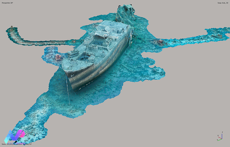
History of SS Thistlegorm
Accupixel believes that the Thistlegorm ranks among the world’s best shipwreck dive sites. However, it serves as a maritime grave for 9 sailors attacked by Luftwaffe aircraft in 1941. Today, at depths of 12-32 msw, the wreck functions as an underwater museum. Attracting Egypt’s Red Sea Tourism and providing a space to reconnect with shared cultural heritage, Thistlegorm is a bucket-list dive. Due to its extensive and encompassing history, this shipwreck remains a favorite for visitation, diving, and study.
A unique site for underwater photogrammetry…
What makes Thistlegorm a unique site for underwater photogrammetry is that it is too big to capture in one dive. Massive complex objects, like this iconic shipwreck, require an approach that ensures not only individual images align, but differing areas of the wreck assemble to form a single, continuous model over multiple dives.
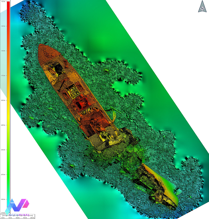
Partnering with Maritime Archaeologists for marine surveys
In partnership with Professor Jon Henderson of Edinburgh University, co-authoring, the paper featured in the Journal of Marine Science and Engineering. Firstly, the paper covers planning, image capture, and post-dive data management of the photogrammetry scans of SS Thistlegorm.
Secondly, the paper also explores the validation of constraints applied to scale the wreck. Entitled, “Recording the SS Thistlegorm: Rapid Multi-Image Underwater Photogrammetric Survey of a Large Second World War Wreck,” Accupixel is proud to present this publication. By using Underwater photogrammetry of SS Thistlegorm, we can identify changes to the site. One full scan of the wreck was conducted in 2017 and in 2022 smaller areas thought to be at risk of disturbance and change were surveyed.
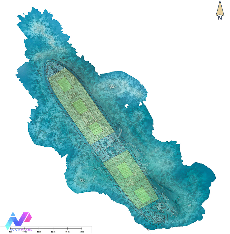
We added vector area data to emphasize the location of the holds (highlighted in yellow) and hold entrances (highlighted in green) Source: Tyne & Wear Museum DS.JLT.4.PL.599.9.2.
In the future, we will publish a separate paper providing a detailed review of the changes identified between 2017 and 2022. This paper reveals a range of differences, including discreet alterations, strong evidence of commercial salvage, and instances of live ammunition disturbance.
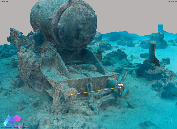
Reading about Underwater Photogrammetry of SS Thistlegorm
We would encourage anyone working in the field of photogrammetry to have a read of the paper, for the methods and techniques discussed would apply to complex and challenging terrestrial projects, as well as those underwater.
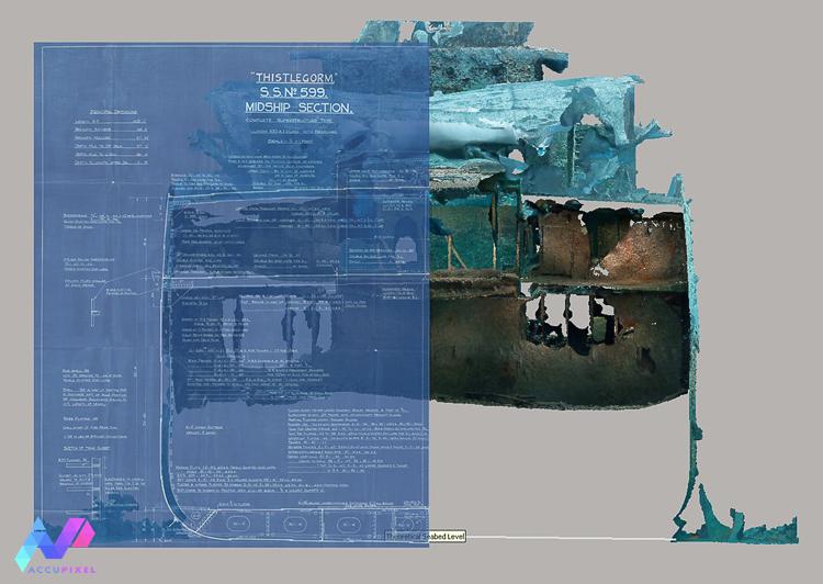
The issues encountered whilst establishing accuracy were challenging but highlight the extreme value of cultural archives, not least of which is the Lloyds Register Foundation whose contemporary documents have permitted direct comparison between the wreck today, and when constructed.
Moving forward with underwater surveys
In conclusion, we extend an invitation to explore history and technology through Accupixel’s underwater photogrammetry study on the SS Thistlegorm. Collaborating with Professor Jon Henderson, we reveal the secrets of this iconic World War II wreck. Our recent publication reflects our commitment and documenting the evolution of techniques.
Considering the nuances of planning, image capture, and post-dive data management, Thistlegorm transcends its role as a maritime grave. It emerges as an underwater museum, inviting enthusiasts to connect intimately with our shared cultural heritage.
Looking ahead, our commitment to unmasking Thistlegorm’s mysteries persists. Furthermore, a forthcoming paper will meticulously detail observed and measured changes over time, providing insights into discreet alterations, hints at commercial salvage, and instances of live ammunition disturbance.
Join us in this immersive journey, where technology intertwines with history, preserving the legacy of a bygone era in every scan.
![]() Keep up with us on LinkedIn here
Keep up with us on LinkedIn here
![]() Like and Follow us on Facebook here
Like and Follow us on Facebook here
![]() Subscribe to our Youtube here
Subscribe to our Youtube here
This is so fascinating. I dived the Thistlegorm a couple of times 20 years ago in my younger, carefree days…
Then a couple of years ago I began making VR experiences, and bought Agisoft Metashape from Accupixel to learn the basics of photogrammetry.
I love it when life joins up like this in happy coincidences. 🙂