Last week we took a look at the UWIS dive logs. With the diver or ROV in the water UWIS starts recording the position on either a 2 or 4 second cycle, capturing latitude, longitude and depth. So, we will be evaluating 3D Modeling and GIS for Underwater Exploration.

You can download the actual track log as a geoJSON file and load it into GIS applications like our favorite, Global Mapper. We can visualise the track in the context of the rest of the planet, and in glorious 3D too:

The 3D view caught the attention of UWIS CEO Pertti Arvonen. We have a few georeferenced models and UWIS tracks from Vobster. Could we combine the two? What more can we learn about 3D Modeling integrated with GIS Exploration?
The models were exported from Metashape Professional with WGS84 reference. Although each chunk is separate their geolocation is recorded and allows us to view the 3D content in context of not only each other, but the rest of the planet.
Building the Scene
We first loaded the UWIS track log and then added each 3D model in turn.

The track log needed a little work to tidy it up with Global Mapper’s editing tools, deleting a few unwanted vertices and using the smooth tool to refine the track and soften some of the harsher changes in position.
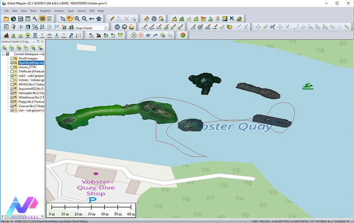
Continuing with 3D Modeling and GIS Exploration. With the track log trimmed and refined the next step was to generate the fly through data:

Export the Video: 3D Modeling & GIS Exploration
With the fly through path sorted the final step is to export the video. In this example, we deliberately left the World Imagery satellite overlay on to represent the surface of the quarry.
The final video isn’t going to win awards anytime soon but that’s not the point here. As a proof of concept, it has sparked several ideas for merging georeferenced 3D photogrammetry with ROV or diver telemetry. Please follow along for more information about 3D Modeling and GIS Exploration.
Interested in knowing more about photogrammetry and 3D Modeling and GIS for Underwater Exploration with Metashape, or GIS with Global Mapper then please use the contact us page to get in touch.