The Agisoft Viewer has been around for quite a long time and helpful in 3D Measurement. Until now its use and benefit has been restricted but the latest release has added more functionality, and in doing so has made the freebie download far more useful. Along with interactivity the Viewer delivers true-to-life virtual scenes in high detail in an easy to navigate way.
For those concerned with privacy or sensitive data the lightweight nature of the viewer is a compelling alternative to online publishing services.
So what is new? Short answer is quite a lot and the the Viewer now supports:
- Multiple layers with concurrent and selective viewing
- Measurement tools for distance, area and volume
- Basic drawing tools
- Viewing session saving
3D Viewing
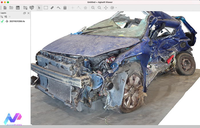
The list of supported formats is – to put it bluntly – impressive with an extensive list of open and common formats. We have not tested them all but have run Agisoft’s own TLS format into the viewer and loaded the results:

The Viewer supports both locally scaled and geo referenced 3D models. Bob Wagstaff of Wagstaff Forensics kindly shared some collision data and we processed the images in Metashape Professional. As long as the exported model is scaled with accuracy applied any dimension may be taken with confidence:

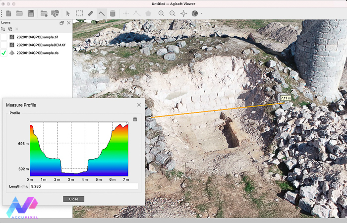
Along with linear measurement we can extract profile data from 3D models:

2D Viewing
Outputs such as ortho photos and DEMs carry a lot of information, communicating subtle data the 3D model alone cannot. The viewer now supports a wide range of geo referenced formats, including vector and raster files.
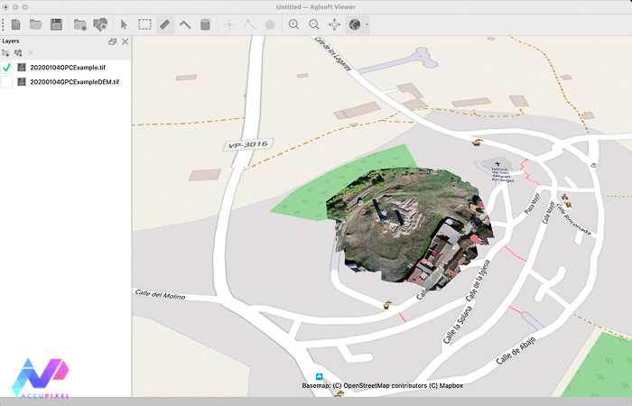
Viewing of 2D content is always in context of the base map, either a map or satellite view:

You can load and view multiple layers in context:

Vector layers allow consumers and viewers to create and save points and basic 2D shapes, which can in turn be exported and saved in exchangeable formats such as SHP, DXF and Google Earth formats.

Summary of Viewer Agisoft 3D measurement
The latest updates to the Viewer raise the bar, making the application far more valuable than previous releases. Both Jose and Simon express their admiration. Customers like it too. The Viewer already resolved a few “how to” issues and helped one client plan to share high resolution 3D and 2D data with users based in the field.
The ability to save, both the project and individual vector layers, really lifts the value beyond a simple viewer and turns it into something far more useful. However, we don’t see this replacing GIS tools such as Global Mapper but for users needing basic tools its a very good fit indeed. We do have to keep reminding ourselves its free and available as an option in the Metashape Professional installer.
We are convinced this Viewer is a hit, and a short training course to teach the finer aspects of what this app can deliver is available in our shop, complete with a set of sample data for students to work with.
Clients, consumers of content, will often want to ask their own questions and measure what they value. The Agisoft Viewer now enables this, not just for Metashape authored content but potentially any source.