The latest version of GPS processing software includes the GPS camera positioning tool. The new release comes with two major improvements:
- Support for GPX file format
- Preview of the positioned images
The inclusion of GPX file formats means we support any GPS recording device capable of saving or exporting this format. Naturally support for UWIS log files remains and we will still use this for our 3D reconstruction, but we do recognise ROV operators use many tools to record position – the latest update makes merging disparate data as easy as drag-and-drop – check out the video below for a brief demo.
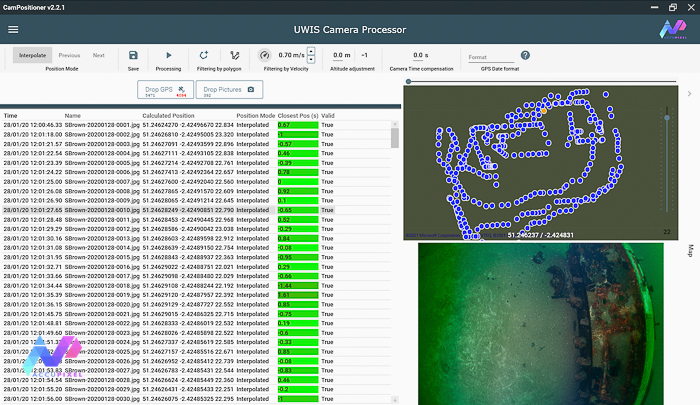
Additionally, we have added a preview of positioned cameras. The map view now includes a position highlight (orange circle) of the selected camera. This visual feedback helps anyone quickly gain confidence the merging of images and GPS position has delivered the expected result.
Additionally, we georeference and scale the low poly model using GPS data from the UWIS log file. We process it in Metashape Professional:
Lastly, the GPS processing software’s camera position tool is now available for purchase and download in our shop and is available free of charge to all AccuPixel UWIS customers.